Hurricane Fiona swell and the Tropics
- September 21, 2022
- 0 Comments
- By Story/Photos By Bryan Davis
With the Gaston swell in the rearview mirror and Fiona poised to send our next big swell to the East Coast. On top of that we have yet another storm that may swing up into the Gulf.
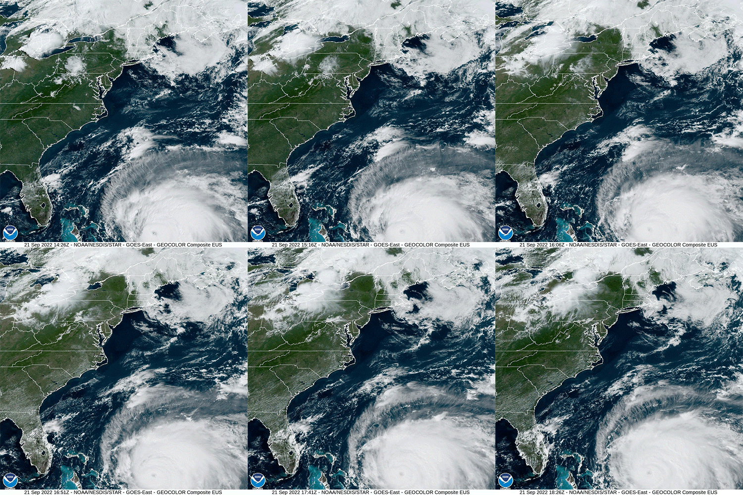
Major Hurricane Fiona continues to head North towards Bermuda where it will likely not make direct landfall but we are still expecting Tropical force winds and rain to hit the island. It has an extremely well defined presentation in Satellite images with a well defined 20 n-mile eye and well defined upper-level outflow.

We are expecting the Fiona Swell to start rolling into Florida very late Wednesday into early Thursday. Expect pretty clean conditions on Thursday but really cleaning up on Friday morning as winds turn offshore on top of possible overhead conditions. I’m expecting to see some barrel shots on social media from this one. Friday afternoon Winds are poised to pick up and turn onshore threatening to blow things out for the rest of the weekend with expected Nor Easter weather conditions. So if you’re planning to paddle out for this one get on it Thursday or Early Friday.
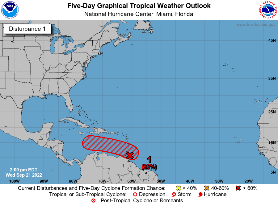
In the future for the Gulf we have a Tropical wave with a formation chance at a 70% chance in the next 48 hour and a 90% chance in the next 7 days, so we are more than likely going to see a named storm in the Gulf in the next week or so. Current models have the wave North of Venezuela moving into the Caribbean Sea where it will interact with warm waters and have conducive conditions for growth.
