Hurricane Nicole Surf and Strom Forecast
- November 9, 2022
- 0 Comments
- By Story/Photos By SurfGuru
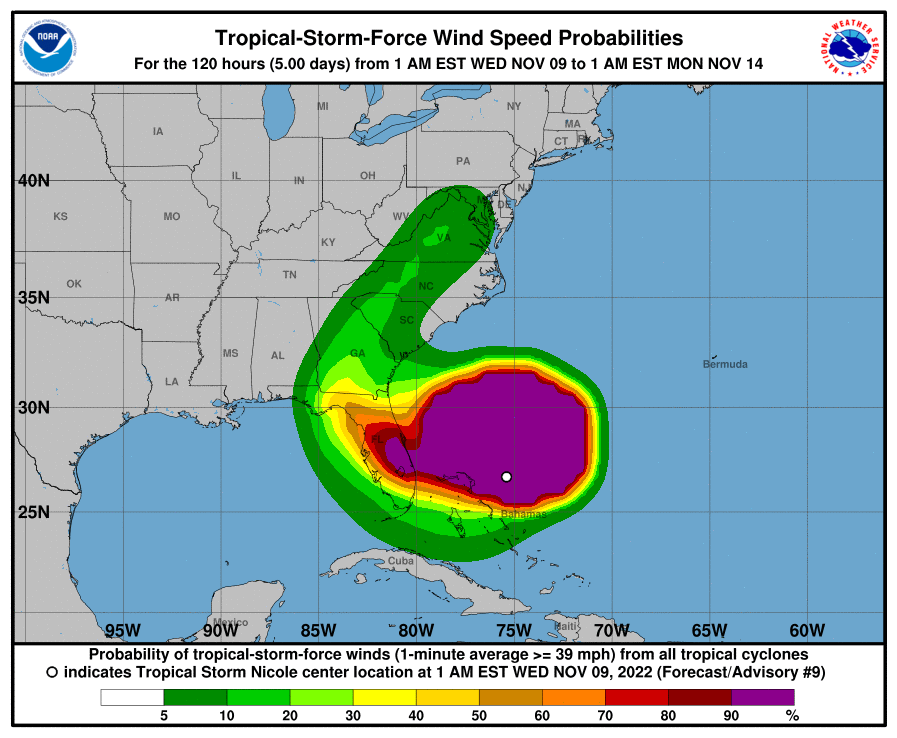
All eyes are on Nicole. Tropical storm Nicole will be continuing its way towards the East Coast and it is looking like it might strengthen to a category 1 storm at some point on Wednesday bringing dangerous double overhead conditions and strong NNE winds, building though the day on Wednesday, to the Florida coast.
Large storm surf and 50+ mph NNE winds continue into Thursday morning and start to drop off as winds shift to the SE. South Florida might see a window of manageable, big for the area, surf on Thursday. Conditions across the coast should improve significantly for Friday with possible overhead conditions and offshore winds if the storm continues on its current track.
While winds could hit 50+ mph, with the highest tide of the month being yesterday on Tuesday, Nicole will be hitting the coast especially hard when it comes to beach erosion. Many beaches are still in poor condition from the impact of Ian and officials are concerned that the additional beach erosion will cause damage to properties and sections of A1A.

Some areas that are still saturated for Ian may also see additional flooding so officials are recommending that people in low lying areas prone to flooding be on alert.
Many coastal barrier islands are under a voluntary evacuation order with the exception of parts of Volusia, Palm Beach and Nassau counties which are mandatory. Please see
https://www.floridadisaster.org/evacuation-orders/ for the latest Evacuation Orders info.