Hurricane Ian Report Sept 27 2022
- September 27, 2022
- 0 Comments
- By Story/Photos By SurfGuru
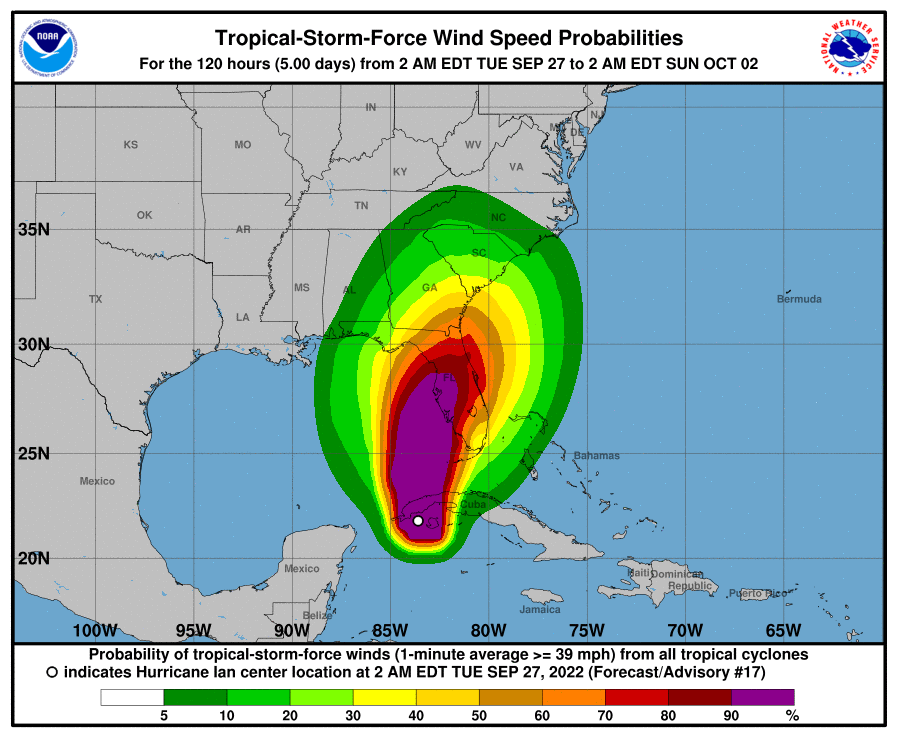
It’s Tuesday morning and the track of the Hurricane has changed once again and is now looking like it’s going to hook into the state around Tampa then run up the I4 corridor or up I75 depending on how things go. The big factor has been this front pushing though the U.S. and it ended up strengthening which is pushing the Ian down and to the east. Because of this new path Ian is expected to be a category 3 hurricane just before it makes landfall around midnight on Thursday.
Once it is over land it will lose energy and intensity and is projected to drop down to a Tropical storm by 2 AM on Friday. While that sounds great, that energy has to go somewhere and since this storm is slow moving and only covering 150-200 miles between Thursday and Friday all that energy is being dumped in the form of Wind and Rain where it makes landfall which can cause wind damage and flooding.
For coastal areas and Tampa Bay storm surge can be the biggest concern. Since Ian will likely be a category 3 right up to the coast the storm surge can be 5-10 feet which is more than enough to cause major coastal flooding. To put things into perspective if you look at the satellite imagery, Ian is already larger than the entire state of Florida and rain bands are already hitting Florida from this storm.
For the latest alerts and to see if you live in a potentially affected area check out the Weather.gov
Threats and Impacts page.
Stay safe.
- Bryan