Hurricane ETA to make landfall on the Gulf Coast
- November 11, 2020
- 0 Comments
- By Story/Photos By Surfguru
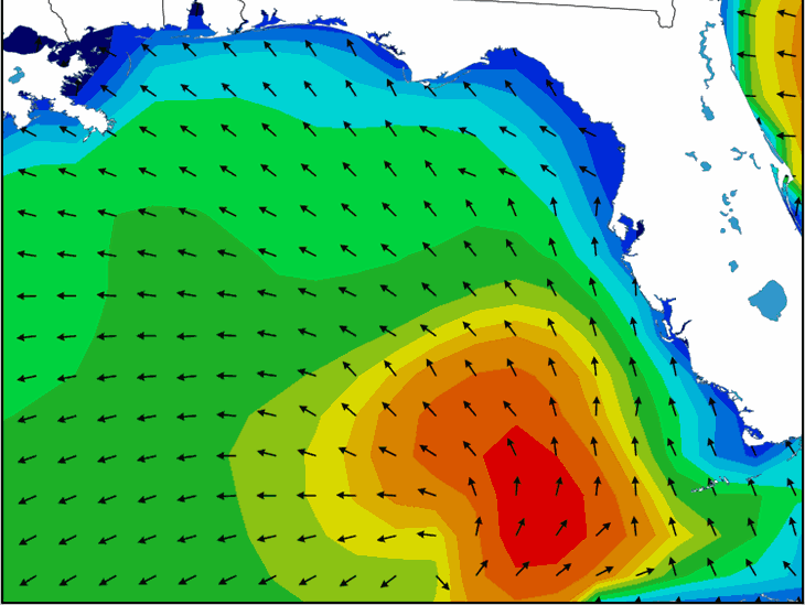
Hurricane ETA is expected to be downgraded to a Tropical storm before making landfall north of Tampa on Thursday morning around 6-7am but the effects of the storm will begin to show up as early as late Wednesday night. The storm is already bringing a rare ground swell to the Gulf coast and Panhandle giving local surfers a late season treat. Get on it today though because things will begin to get gnarly as the day moves on and this one will pass over quickly.
More Info from the Hurricane center.
At 1000 AM EST (1500 UTC), the center of Hurricane Eta was located
near latitude 26.2 North, longitude 83.7 West. Eta is moving toward
the north-northeast near 10 mph (17 km/h), and this general motion
is expected to continue through Thursday. On the forecast track,
the center of Eta will move closer to but offshore of the southwest
coast of Florida today, approach the west-central coast of Florida
tonight, and move inland over the northern portion of the Florida
peninsula on Thursday. Eta is expected to move northeastward into
the western Atlantic late Thursday or early Friday.
Data from NOAA Doppler weather radars indicate that maximum
sustained winds remain near 75 mph (120 km/h) with higher gusts. Eta
could be near hurricane strength tonight as it approaches the west
coast of Florida, with rapid weakening expected after landfall on
Thursday.
Hurricane-force winds extend outward up to 60 miles (95 km), mainly
northeast of the center, and tropical-storm-force winds extend
outward up to 115 miles (185 km). A sustained wind of 33 mph (53
km/h) and a gust to 42 mph (68 km/h) were recently measured by a
Weatherflow observing station on Sanibel Island. Across the lower
Florida Keys, a sustained wind of 39 mph (63 km/h) and a gust to 49
mph (91 km/h) were recently reported at Sand Key.